Order by the city of Munich – data update and software 2023/24
12.02.2024
We are delighted and very proud to have been awarded the contract again by the city of Munich for mobile mapping data recording and provision via software in 2023. The state capital of Munich is once again relying on the proven digital road for street navigation and data updates in 2023, the state capital of Munich is once again relying on the proven digital road with infra3D Data from iNovitas.
After the use of the infra3D solution (data and software) has become an integral part of the Smart City Munich over the last 4 years, we are now updating the database of digital streets (approx. 3900 km) in September and October 2023 and March and April 2024 we are now updating the database of digital streets (approx. 3900 km) with the latest reality capture technology. We would like to thank the City of Munich for the trust they have placed in us and look forward to working with one of the most innovative cities, which consistently derives the use of digitization from the benefits for the people.
The newly captured image data in 2023 will then be mapped in the existing infra3D software of the city of Munich and can thus be used and compared with the image data from the previous campaign (2019) (historicization of the 3D image data). This possibility of being able to display situations and developments of conditions over time in infra3D is valued by infra3D users, as it provides a “time-shifted” basis for decision-making.
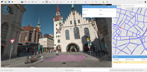
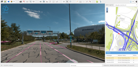
The infra3D software enables the city of Munich to use a highly accurate digital image of its street space and public places. Virtual on-site analyses of public spaces, 3D measurements, digitization of objects in the street space, and much more can be done efficiently and on the basis of the latest data, an added value from which the entire city administration benefits.
Various administrative departments have been using infra3D in a variety of ways since 2019:
- Virtual inspections and 3D measurements (distances, areas, coordinates, cross-sections)
- Survey and inspection of traffic signs and road markings, trees, benches and parking spaces
- Planning and visualization basis
- Basis for digital models of infrastructure buildings (Building Information Modeling – BIM)
- Virtual test drives of temporary detours and alternative routes
- Efficient processing of applications for the use of public property, etc.


