The software toolbox for your individual needs
Our program library for integrating the 3D geo image data service into your existing applications
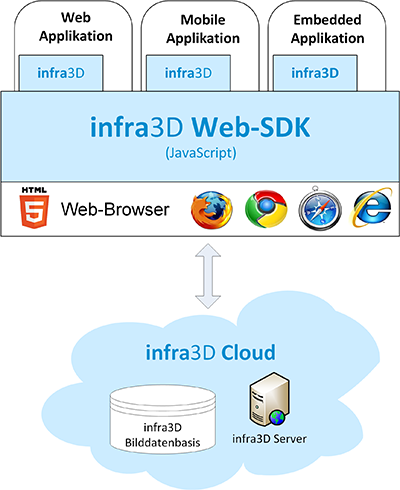
infra3D Web SDK enables you to integrate infra3D service directly into your web or desktop GIS, street information system or your third party application. The software toolbox (SDK - Software Development Kit) is a JavaScript based program function collection which abstracts the access and functionality of infra3D so that they can be used for your own needs.
Range of functions
- Display and streaming high resolution 3D mono images
- Navigation in the image database (eg. via the map interface)
- Coordinate measurement in 3D mono image (one-click procedure)
- Transfer of any geoobjects for correctly positioned superimposition
- Standard functions for measuring surfaces, distances, perpendiculars, coordinates, profiles etc.
- Standard functions for surveying and mapping geoobjects
- Layer-style options
- Access to linear reference system functio
Requirements
To run infra3D Web SDK, a HTML5 enabled web browser is required. We would be happy to advise you about this and to show you the possibilities of web SDK in person.